Wednesday, August 18, 2010

Home

So, I'm finally back home in Vermont.

It's been a great couple of days so far.

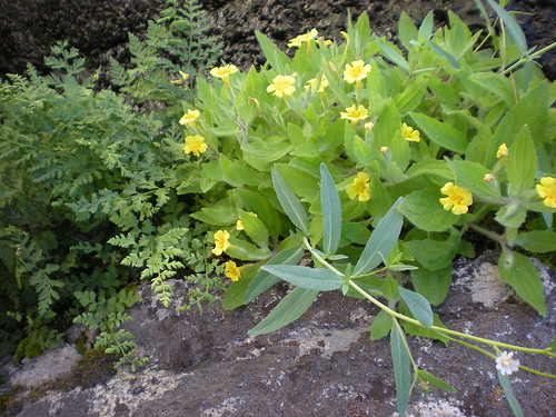
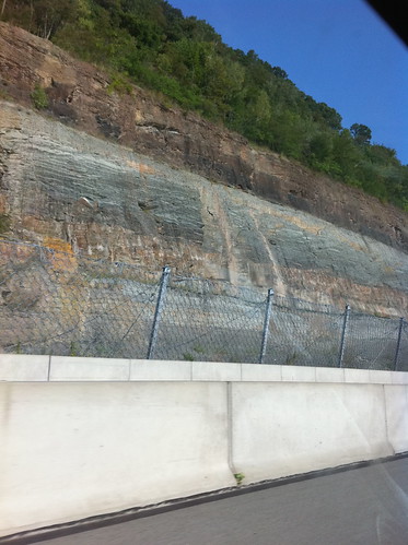
Pennsylvania Roadcut
Roadcut in Pennsylvania on the drive home.

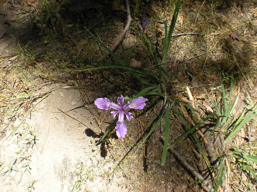
Lake Abbey Trail
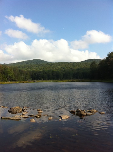
Abbey Pond Trail near Middlebury, Vermont.

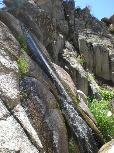
Lake Abbey
The pond!

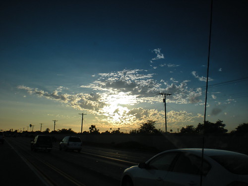
Burlington Sunset
The sunsets have been great lately!

Sunday, August 08, 2010

In the last year...

A little over a year ago, Eli and I got on the Plattsburgh ferry, and rode across from New York to Vermont.


While looking through old photos I found that video today.

It is amazing to think how much as changed since then! The transition from California to Vermont was difficult in some ways, but it was very, very needed. Almost all of the last year has been amazing, even the parts that were also rather hard.

I'm going back to Vermont in 6 days. My project in Pittsburgh has been amazing so far, and in some ways I am sad to leave. However, I miss Vermont, and in particular, there are certain people I really miss. There are also new people to meet - including 8 people entering the grad program I am in. These are people I am going to be spending a lot of time with, and if they are anything like other people I have met through this program, they will be amazing.

This last summer has been an important and productive one, though it also had its difficult moments. Summer is actually my least favorite season, although I like it a lot better on the east coast than out west. In coastal California, summer is something to be endured, a hot time, where many years the only water to touch the ground between May and October consists of the welcome, but very sparse, moisture that trees and shrubs condense from fog. It is difficult for much of the season to be able to perceive a transition to better times.

In Pittsburgh, and also in Vermont, summer is more of an arc. Although late summer has its share of hot days and thunderstorms, the air *feels* different... the sun sets a bit earlier (this change a bit less welcome than others), and the animals and plants are just a little more rushed and frantic in preparing for colder times.

Sometimes they overreact, and are a bit too prepared.
Early
This maple is certainly missing out on a lot of warm days in which it could store food for the winter. In all honestly, it is probably sick or drought stressed. Still, it was the first sign of fall in what has been a very long and hot summer.

Saturday, July 31, 2010

Two Minutes from August

Well, as I start typing this post it is exactly two minutes from August.

My project is going well... it's been an interesting and at times difficult summer - but most of the challenging things have been personal events that didn't have to do with my project. As my time in Pittsburgh nears its end (two weeks left!) I feel that I have a lot of neat ideas and good stuff to work with in the coming year. It's just a matter of organizing it, and next week presenting it to various people here before I go.

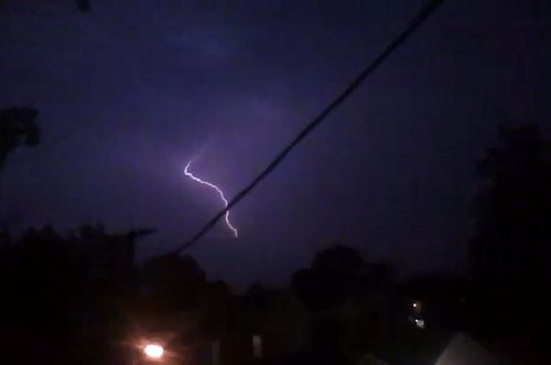
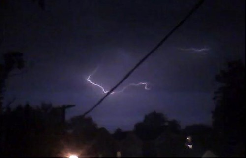
Although the nasty heat wave of early July has abated, it still has been hot at times. July was a month without a lot of rain, but with quite a bit of lightning, especially at night. Some of it was quite beautiful, as evidenced by the previous post and by these pictures.

28_july lightning 5
28_July Lightning 1
28_july lightning 2
28_july_Lightning_0

It's been a good summer professionally, even though it was sometimes hard on a personal level. I look forward to applying some of my ideas but also being back home in Vermont with my friends and especially Becca...

Saturday, July 24, 2010

Heat and Thunderstorms

I knew I said I would doublepost everything on slowwatermovement.blogspot.com here also but honestly I haven't had the time or motivation to do that, so I really haven't. If you have to choose one blog to check, check the other one because I update it more.

It's been quite hot here. Last night there was a wicked line of thunderstorms to the north that made some really neat lightning but never made it to town.


Tonight there is another similar line of storms, but it is a bit closer and moving a bit faster. Perhaps this one will make it to Pittsburgh. In any event it looks like there will be more lightning to watch out my window.

Watching lightning and drinking a good cold beer is about all one could expect to do on a hot night like this.

Wednesday, July 14, 2010

Loss and Renewal

My grandfather passed away in late June. My uncle passed away just shortly before my grandfather.

My grandpa led a full life, and made a positive impact on so many family members and friends. He died at a respectable age of 88. My uncle likewise positively touched the lives of many, but he died too soon.

Both of them died of lung cancer. Please don't smoke. There is no way it is worth this.

I was especially heartbroken that my grandpa died before I was able to see him. I got plane tickets immediately when I heard that he was ill... but the cancer was already at an advanced stage and he was not able to fight it off for very long. Over the years I have traveled to many beautiful and amazing places with my grandma and grandpa, and I was sad that I did not get to see him before he left our lives this last time.

I still went to California to see my family. It was not a happy trip, but it was an important one.

_DSCN1465

On Saturday, an unusual light rain shower passed through downtown.

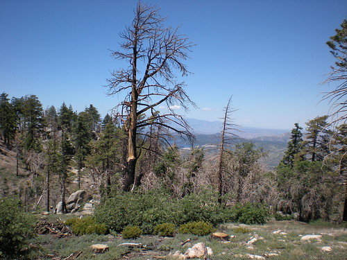
On Sunday my dad and I went up to our family cabin where we have shared many good times. A few years ago, a fire ripped through the whole area, killing many trees I have 'known' since I was very young, drastically altering the landscape, and almost destroying the cabin.

_DSCN1479

In some cases the fire was beneficial to the forest but in other cases it burned more hot than it naturally would, due to natural fires in the past being suppressed. There are whole areas of dead forest. There is also rebirth.

The number and variety of flowers is higher than I have ever seen this time of year.

_DSCN1498

_DSCN1481

There was also a lot of water. True, it was a snowy winter, but even during wet years I have never seen this much water this late in the year. Many of these creeks usually only run in the spring.

_DSCN1488

_DSCN1497

_DSCN1501

Both death and renewal were around us everywhere we looked. It is amazing to me that such destruction, and so much beauty and rebirth, can happen side by side.


_DSCN1511
Goodbye, Grandpa... I love you and I sure will miss you.

Sunday, July 04, 2010

Update!

Hi!

I made several posts in the Slow Water blog this last week. I am lazy right now and don't want to repost all three of them so go check them out here.

Last weekend I went to Vermont to visit Becca. We were going to meet half way between Vermont and Pittsburgh but she was feeling sick so I went all the way to Vermont instead. (she is feeling better now.) Although it was a long drive, it was nice to be back in Vermont because I love Vermont!

_DSCN1313

I stared at the New York Thruway for a long time. Luckily i had a bunch of Car Talk and This Week In Science podcasts to listen to.

_DSCN1318

Apparently even the gas stations are nice in Vermont (I agree). Another nice thing about Vermont: Billboards aren't allowed, so this billboard was actually on the New York side of the border.

_DSCN1319

Yay!

_DSCN1329

Vermont is so pretty!

_DSCN1316

This is a weird van from the drive. I thought of spicy barbecued oxygen, or the air that bison breathe. Of course, it was actually just a van from near Buffalo, New York.

Tuesday, June 22, 2010

Getting Out of Town: McConnells Mill State Park

I took a trip yesterday to McConnells Mill State Park, about 50 minutes' drive north of Pittsburgh. I wanted to see what non-urban forests looked like in this area and also thought it would be nice to get out of the city for a day.

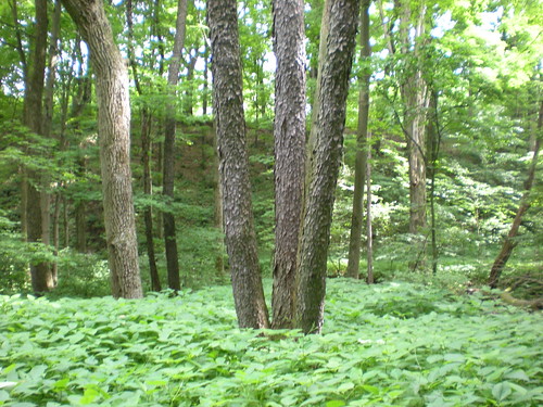
The state park is nice! In many ways the forest is similar to the ones I am used to seeing in the Champlain Valley of Vermont - with abundant oaks, maples, and hemlocks and some basswood and black cherry trees tossed in for variety. There were a few reminders that I am further south too, such as a few tulip trees and sycamores (which occur only in far southeastern Vermont) and an rhododendron in the understory.

_DSCN1273

Black cherries and other deciduous trees! There were also dense hemlock groves but my pictures of them didn't come out very good since it is DARK in there!

_DSCN1279
Black cherry bark is sometimes referred to as 'burnt potato chips'. This tree is valued by many animals which eat its bitter cherries, and by foresters and furniture makers, who value the beautiful wood in these trees. Black cherries need to grow up in a bit of sun, so their presence here suggests some sort of human or natural disturbance in the past.

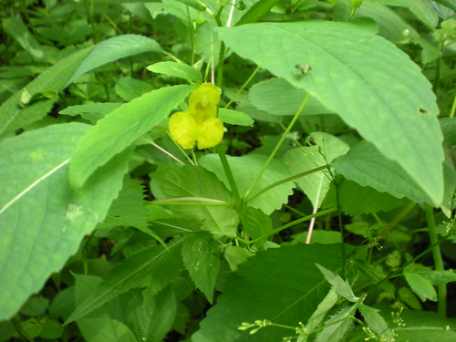
_DSCN1275

This is pale touch-me-not, a relative of jewelweed. This plant likes relatively rich soils, as does the basswood that also grows in the area. Farmers also like rich soils, and most areas surrounding the park that are not very steep are used as farmland.

_DSCN1268

This is Slippery Rock Creek which flows through this canyon:

_DSCN1299

The canyon was cut about 140,000 years ago when smaller creeks flowing north were blocked by a glacier, forming a lake that spilled over a ridge. As such, the canyon is much 'younger' than the features around it (the Appalachians are a very ancient mountain range). The steep walls of the canyon are mostly forested, and within the state park.

_DSCN1299

In this way, the park is like a larger version of Schenley Park and Panther Hollow. There are of course not as many urbanized areas around the state park as around Schenley Park, but most of the flatter areas adjacent to the canyon are agricultural or pasture land, which i suppose is somewhat similar to the golf course and manicured lawns in the flatter parts of Schenley Park.

_DSCN1272

My favorite part of the park was the poorly-named "Hells Hollow" area. The only thing hellish about the area was the mosquitos - but otherwise it was a beautiful and interesting place.

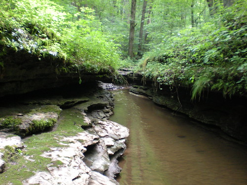
_DSCN1289

Hell Run has carved its way into the rock and created a channel which actually looks like a natural version of the concrete channels of the city. It is of course much prettier, but not much absorption or filtration of water happens here!

_DSCN1290

These ripples are not in sand or silt deposited in the creek, but part of the solid bedrock in the channel! It appears that the bed of this creek is in a fossilized lakeshore or silty riverbed from millions of years ago... I had to actually touch the ripples to believe that they were solid rock.

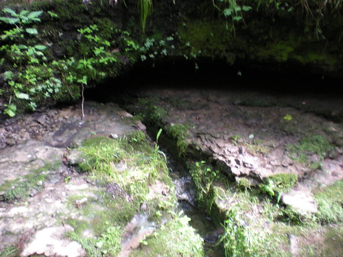
_DSCN1288

This is a little spring that has cut its own channel out of the rock. Like all springs, this one gets its water from precipitation that soaks into the ground and/or through cracks in bedrock and is forced out later. This water probably fell as rain or snow months or even years ago. Thinking back to Pittsburgh, one of the consequences of having so much concrete (and not enough rain gardens) is that water is not seeping into springs as much as it used to.

_DSCN1295

There's also a great waterfall, which is an easy hike from the parking area.

This visit allowed me to get out of the city for a bit and experience a more 'natural' area, but it also reminded me that Pittsburgh also has a similar (though smaller) natural area right in the middle of the city!


More information on the natural history of McConnells Mill State Park is found here.

Monday, June 21, 2010

My new 'slow water' blog

I have created a new blog about my project in Pittsburgh at slowwatermovement.blogspot.com. There is no need to check both because anything I post on there I will probably post on here too. It will be more relevant to my project though, so if you like those posts, but don't want to read about Neahga turning trees into trebuchets or whatever else I post about, read the 'slow water' one instead.

Sunday, June 20, 2010

Exploring historic channels in Squirrel Hill

Yesterday I went on a mission to look for lost streams. These lost streams once flowed through the area now known as Squirrel Hill in Pittsburgh, but now are re-routed into a combined sewage-storm drain system.

The two streams I searched for are the northeasternmost in this map I posted in my last post:
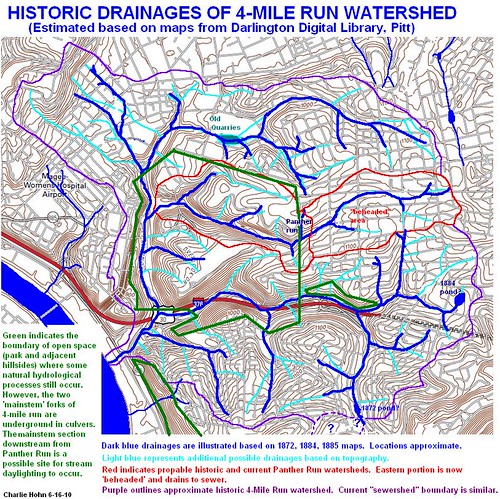
Historic Drainages of the 4-Mile Run Watershed

My approximate route can be found here.


The creek 'disappears' in the southwestern corner of that route, where I started my walk (downstream/west from there it is relatively natural until Panther Hollow Lake). Upstream from here, Bartlett Road follows its course for about a block

_DSCN1198

It is hard to tell there, but Bartlett is in a subtle valley.

Murdoch street is a neat street with cobblestone and brick paving that crosses the old channel. You can see the swale where it crosses the road just north of Bartlett.

_DSCN1205

The channel followed along the current route of Forbes Road for a bit. Forbes and Murray, a major intersection where the Jewish Center and the Squirrel Hill Carnegie Library are located, was near the headwaters of this stream. In this area, the stream probably only flowed during or right after heavy rain or snowmelt.

_DSCN1215

Looking south on Murray, one of the upper channels was probably in the low spot in the distance.

The intersection of Forbes and Shady is near the watershed divide between the Panther Hollow subwatershed of Four Mile Run, and the Nine Mile Run watershed.

_DSCN1220

This photo is looking east. Anything over that rise historically flowed into Nine Mile Run instead of Panther Hollow. The underground 'sewershed' is approximately the same to this day.


_DSCN1222

This little divide on Shady Avenue near Aylesboro Avenue represents the old divide between Panther Hollow and an apparently unnamed little creek that drained the area to the north.


This creek started out flowing down Solway Street.

_DSCN1227

Solway Street has a lot of open lawns and could be a great candidate for rain garden installation... but many of the garages on the north side of the road, near the original channel, are sunk into the ground, so it would be necessary to make sure flooding wouldn't affect these areas due to poorly designed stormwater management structures.

At this time storm clouds started gathering...

_DSCN1230

Wightman Playground at Wightman and Solway is sunk into the ground, and appears to be part of the old creek valley.

_DSCN1234

To my surprise, along the old channel I found one of my old enemies - a tamarisk plant! This plant causes a lot of problems in waterways in the Southwest, and there is a lot of debate over what should be done about it. In this case, the channel is long gone, so the tamarisk can't do anything to it. I doubt it is invasive in Pennsylvania anyway.

_DSCN1239

Since it isn't displacing native species or salting up the soil in this case, I can look at it notice that it is actually quite pretty. I still had to control an urge to go chop it down.

This channel then used to shoot down a canyon that Beeler Street is in now. It is still steep enough that you can get a feel that it used to have water flowing through it. The whole thing shoots into Carnegie Mellon, which I will explore later.

_DSCN1245

I walked back to my starting location along a small historic channel that used to shoot up Forbes Street.

_DSCN1247

In this channel I found... WATER! It turned out that it appeared to be from over-irrigation of a lawn.. but there were some signs of seepage along Forbes Road that could indicate the water table is still near the surface here.


Near the golf course I found a tiny channelized 'stream' with erosion deposits.

_DSCN1253

I imagine with some sort of modifications, this could possibly be naturalized a bit more... at least slowing the water down before it shoots into the nearby sewer drain.

I made it home before the gathering storm hit. It was another impressive thunderstorm with lots of cloud to ground lightning so I am glad I didn't decide to weather the storm in the park, which I briefly did consider.

_DSCN1255

The storm seemed significant enough that it probably caused yet another sewage overflow event to occur.
After the storm cleared there was a nice sunset. You can see another storm way off in the distance; that storm did not hit Pittsburgh and went somewhere to the north instead.

_DSCN1256


So... what is the future of these lost drainages? They are going to have to stay lost for the foreseeable future, since Squirrel Hill was built right on top of them. If you live in this area, you won't be able to see these lost streams again, but you can still restore some of the 'micro hydrology' of the area by building a rain garden or other water art that allows rainwater to percolate into the soil.
Friday, June 18, 2010

Channels of the Past

Yesterday I found a bunch of historic maps of Pittsburgh, on a Pitt site called the Darlington Digital Library . These maps, spanning from the early 1800s to the mid 1900s, showed the growth of Pittsburgh and, in some cases, the locations of waterways within the growin city. As mentioned earlier, most of the 4-mile Run watershed runoff has been routed into combined sewer-stormwater runoff channels underground. I thought it would be neat to map the old creek channels on a current map of the city, so I downloaded a USGS topo map and did just that! Sorry about the small size, the large size doesn't fit the format of the blog, so just click on it for a zoomed in view.

Historic Drainages of the 4-Mile Run Watershed

This map is inexact, of course, due to the changes in road locations over the years and just general accuracy issues (some of the old maps did not appear to be quite to scale). It gives a good idea of what the area was probably like in the past though. The dark blue streams are those that I found on the maps, and the light blue streams are additional places where water may have flowed based on the topographic map. The purple line delineates the approximate historic 4-mile run watershed, and the red line delineates two parts of the Panther Hollow watershed. I'll talk about what a 'beaheded stream' is later, in another post. The green line delineates areas of mostly natural vegetation - most of the creeks in these areas are still partially intact, except the western branch of 4-Mile Run at the far western edge of the map (more on this later too!)

So, now what? My plan for this weekend or next week is to get out there and look for evidence of some of these old channels! Most of them will be ineligible for restoration ('daylighting') due to the density of the city around them. The western portion of 4-mile run was put underground in the early 20th century when the creeks ran with raw sewage. In that state, the creek was a health risk and was buried. Now that things are a lot cleaner, there is a plan to 'daylight' a portion of this creek, if funding and political support are obtained. I'll post more about this later, too.