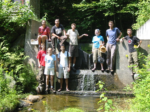
2011 FNEP team (plus one additional grad student). Team name TBD (Allium?).
This is a station to gauge water flow and monitor nutrients flowing out of a watershed (not a gross culvert as it appears). It's the same place where this photo from the Ecological Planning website was taken.
Sunday, August 23, 2009
Subscribe to:
Post Comments (Atom)
4 comments:
Hey, Charlie, neat blog! I was reading the Camel's Hump, non-beaver-dam entry - the closest one I know of to your place is down Pine St behind Myer's Bagels (across from Great Harvest) - you can also see it from the trestle on the bike path. if you take the bike path, check out the stones in the lake - it looks like there was a building at one point in an area now underwater, as there are lots of old marble slabs out there, but it may just have been trashed/repurposed as fill... anyway, I'd be curious to get your take on it. cheers!
A beaver dam? Neat, I still have a lot of exploring to do around here. I also need a bike, though, but I think one of my friends may have a lead on that.
Definitely need to go find the underwater building too, the 'abandoned ruins' thing is a lot more prevalent here than back in California. Also, I'll bet one of my friends knows what it is!
hey, keep me posted on what you find, ok? (I like your scientist blog, too)!
Definitely!
I was going to give you the URL to the fake science blog too but I didn't want to clutter up my paper with stuff.
Let me know when you're getting close to Atlanta, I'll ask Eli for ideas on plant resources and hiking places.
Post a Comment